
GPS system with two fuel level sensors on Renault Magnum
Technique: Renault Magnum tractor unit
Task: GPS monitoring of freight transport throughout Europe, tracking the route of movement, mileage, idle time with the engine running, stops, overspeeding moments, monitoring fuel consumption, including idling, the presence of facts of refueling or draining fuel.
Tariff plan: "International" 245 UAH / month.
GPSM Service Center: Kiev, Academician Korolev Avenue, 13b
Registration for the installation is made by the number:+38 (097) 696 84 07 (Viber, Telegram)

Equipment:
- GPS-tracker for a truck that tracks the location, transmits information about the speed of movement, the number of stops, long stops and the route of movement.
- Digital fuel level sensors 2 pcs., transmitting information about the amount of fuel with regular measurements.
Installation process
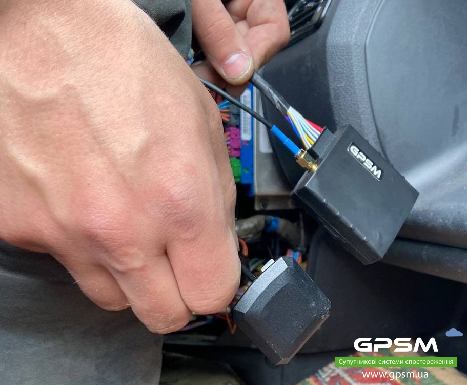
First step. At this stage, a tracker equipped with antennas for transmitting information via a standard GSM network is installed in the cockpit. Installation is carried out in a hidden place so that the driver cannot find and turn off the device.
Second step. Fuel level sensors are inserted into the fuel tanks, which are responsible for taking readings. They are highly accurate, so they can detect fuel drain even while driving.
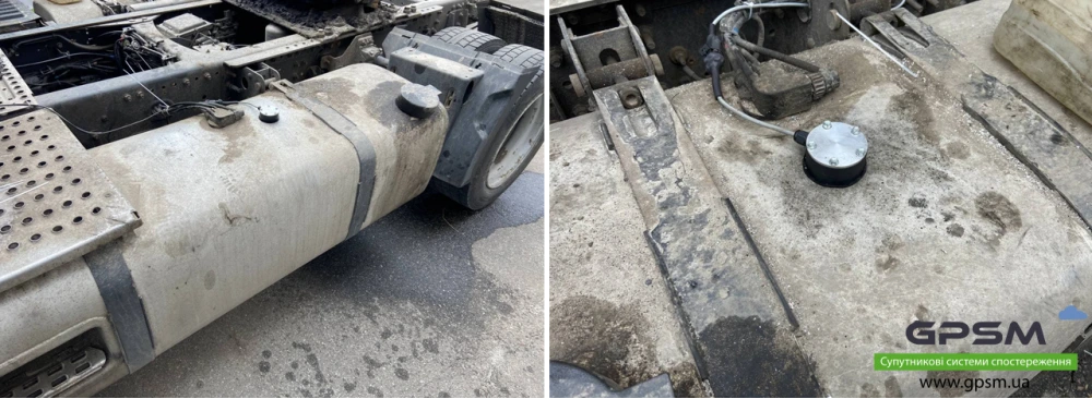
Step three. A cable is laid through which the FLS transmit information to the tracker.
Fourth step. The sensors are being calibrated to set the full and empty tank levels. To do this, after cutting the FLS to the height of the tank, the sensor is first completely lowered into the fuel to set the value of the full tank, and then removed from the fuel to calibrate the empty one.
Fifth step. Calibration is a technological procedure that is carried out to adjust the accuracy of data on the fuel level in the tank. For this, the tank is filled in portions in order to assign a corresponding volume of fuel to each sensor value.
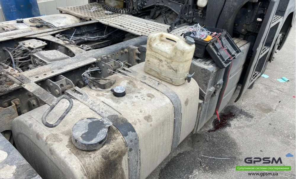
Sixth step. When the entire system is assembled, fully configured and ready for use, it undergoes a sealing process. This prevents any interference with its work in order to obtain its own benefit. We use seals that are destroyed after the slightest impact and cannot be restored.
At the final stage, the customer receives data to enter his personal account, which are used to view statistics and archived information.
Software
In order to conduct GPS monitoring both on the territory of Ukraine and throughout Europe, a modern program called Local GPSM is used.
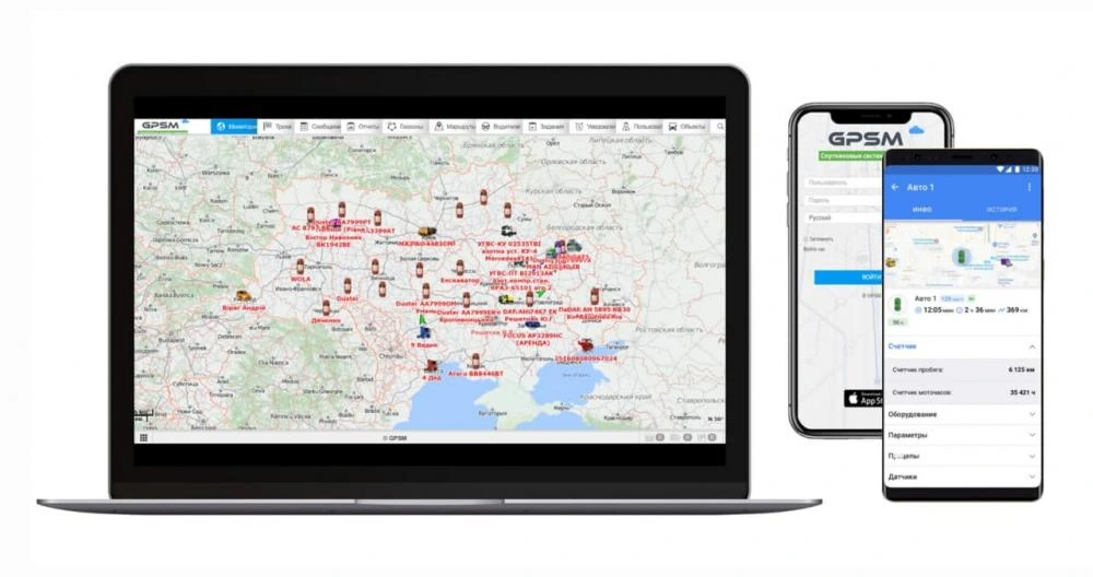
It allows not only to monitor the position of the car and the main indicators in real time, but also to view the archive stored throughout the year. There is both a version for viewing on a computer through a browser, and a mobile application that runs on iOS or Android operating systems.
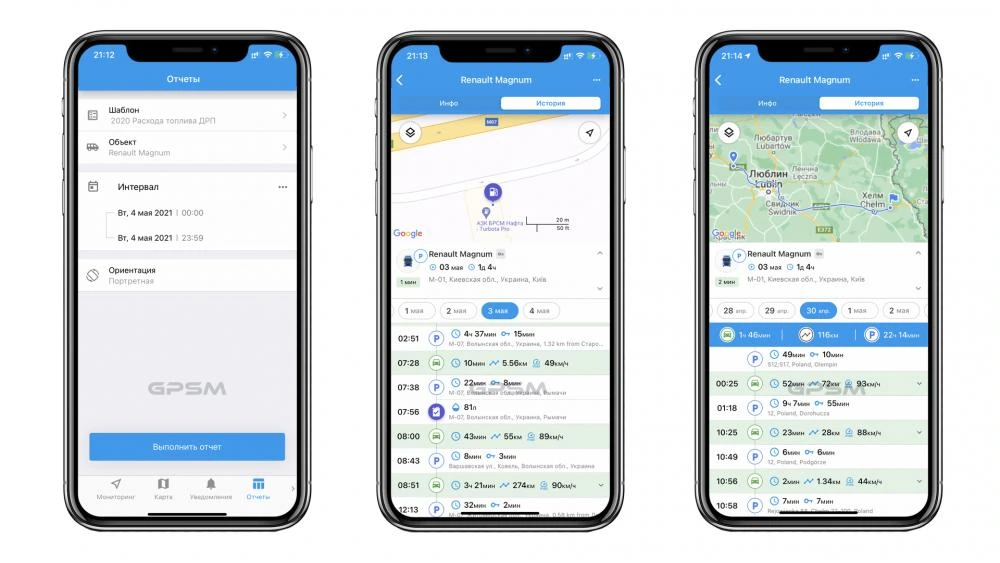
The list of the main functions of the software includes:
- tracking the position of the car in real time;
- monitoring the speed of movement;
- saving the routes along which the car moves;
- total mileage for a certain period of time;
- collection of data on turning the ignition on and off;
- control of the number of engine hours;
- fuel consumption control;
- tracking fuel drain, including when driving, or underfilling at gas stations;
- control of the number of arrivals at gas stations;
- monitoring the fuel level in the tank;
- collection of comprehensive travel reports;
- notification about getting into an accidentl;
- the ability to export the report in one of the convenient formats.
Online location on the map
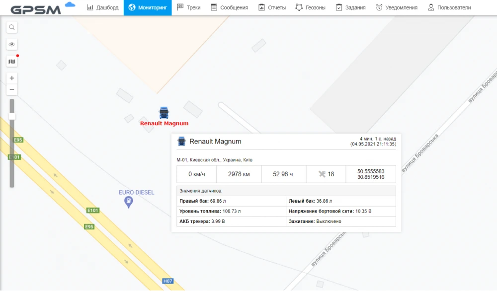
The "Monitoring" tab displays the current data: the position of the car on the map (address and coordinates), speed, fuel level.
Mobile app
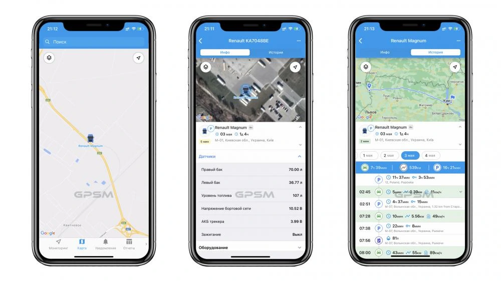
Almost all the functions that are available in the browser version are implemented in the mobile application. It is able to track the current location of the car, display fuel level data, send event notifications to the screen and create reports that the user can save in PDF.
Popular reports
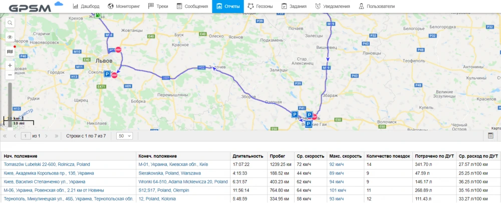
In addition to information about the movement of equipment, information about the place of refueling or long-term downtime is also stored. The average or maximum speed for the trip can also be displayed.
Total stats
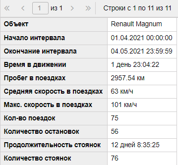
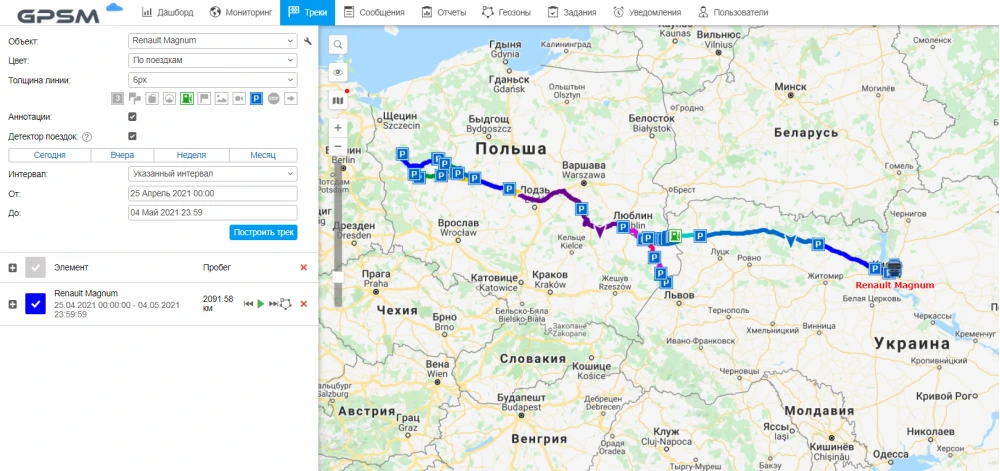
Travel track. This mode displays the number of trips and the distance traveled for a single trip with speed data.
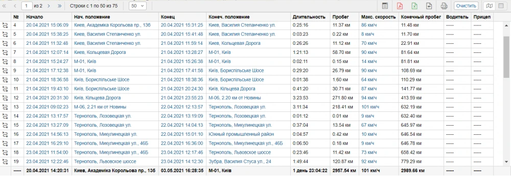
The report includes the date and address of the start and end of the trip, the duration and mileage for the trip.
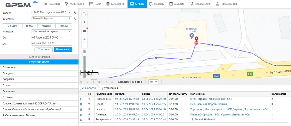
Stops report. Contains a list of all points of stay in one place, the duration of which does not exceed five minutes.
Parking. This report includes all stops during which the vehicle has been parked for more than 5 minutes.
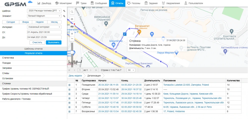
Gas stations. Each time the fuel level is refilled, data is collected about where it was made and how the sensor readings have changed.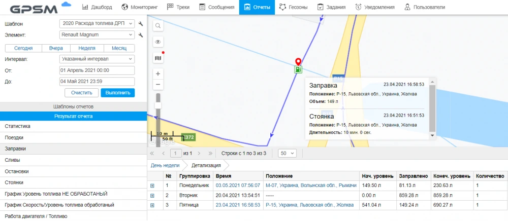
Fuel consumption report. It is formed based on the data of the fuel consumption sensor and the traveled mileage.
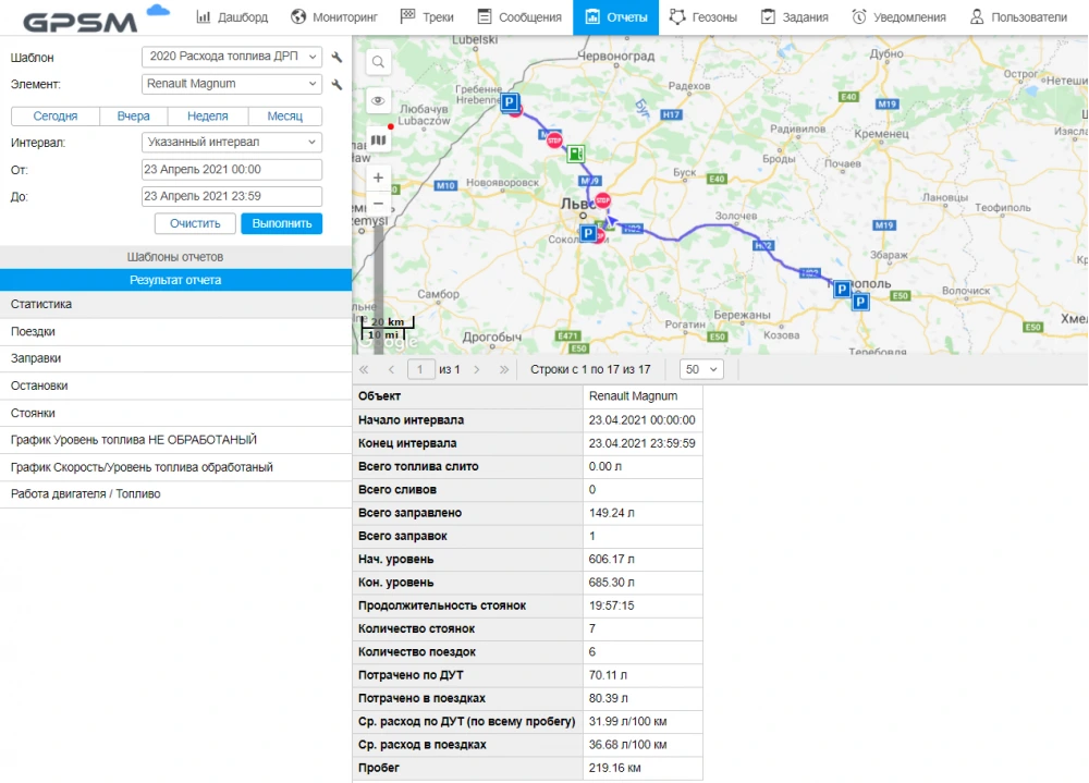
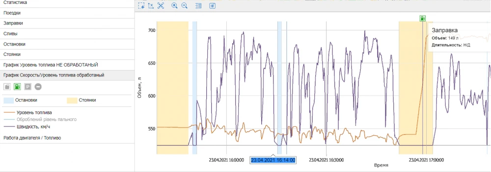
Fuel consumption graph.
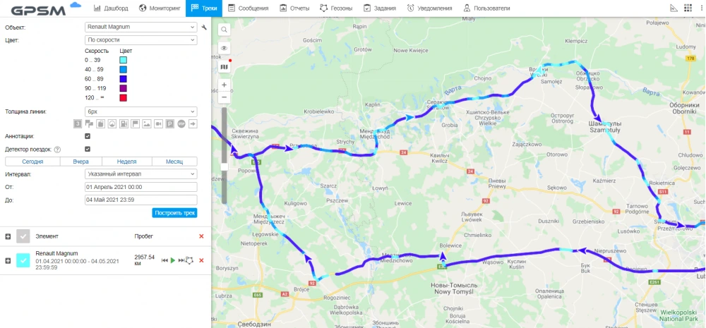
Building a track with displaying the speed mode.
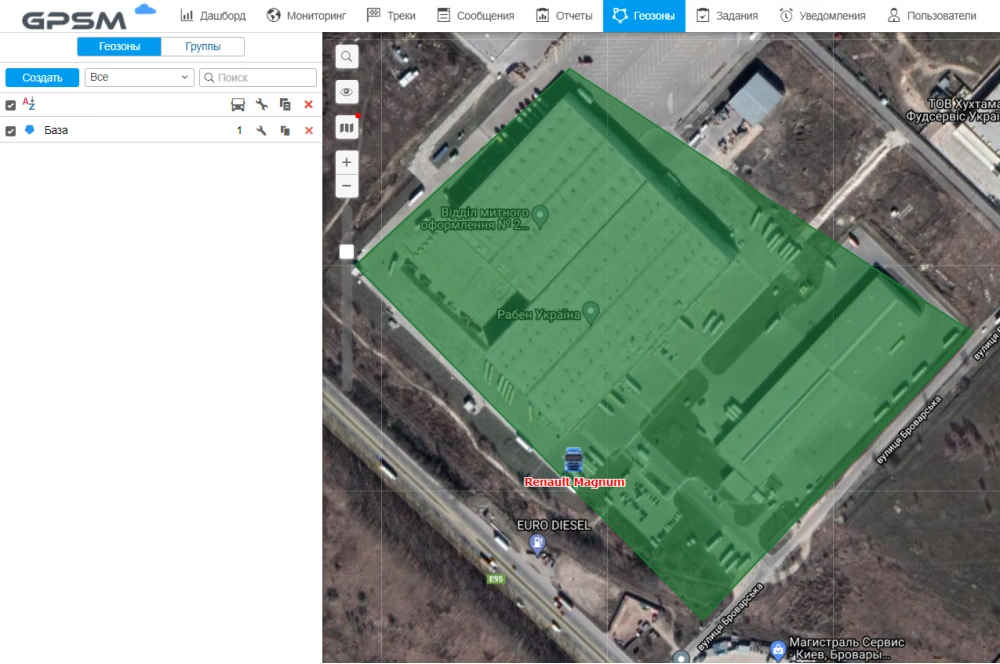
If you set a certain territory on the map, then the event when a car crosses its borders will be included in the report on visiting geozones.
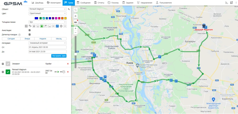
Building a track for a certain time interval in one color.
Consultation
Monitoring system settings are made individually for the needs of your company. For advice, you can contact us by phones: +38 (044) 62 29 56, +38 (097) 696 84 07 (Viber, Telegram), send a request to info@gpsm.ua or come to our office at: Kiev, Academician Korolev Avenue, 13b.

Comments
Thanks!
Your comment has been sent.
Be the first to leave a comment here!